




Batten down the hatches, as they say.....
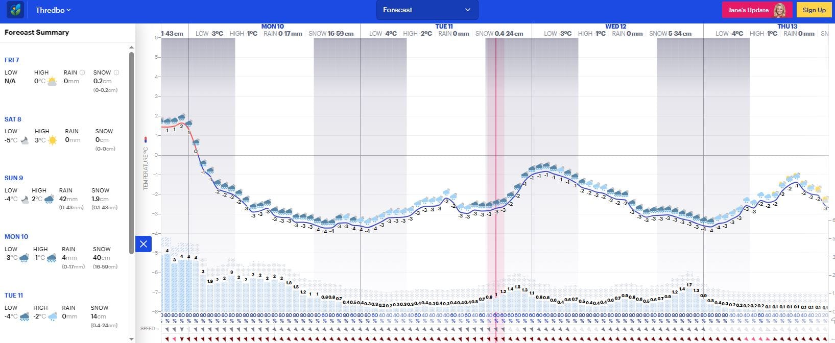
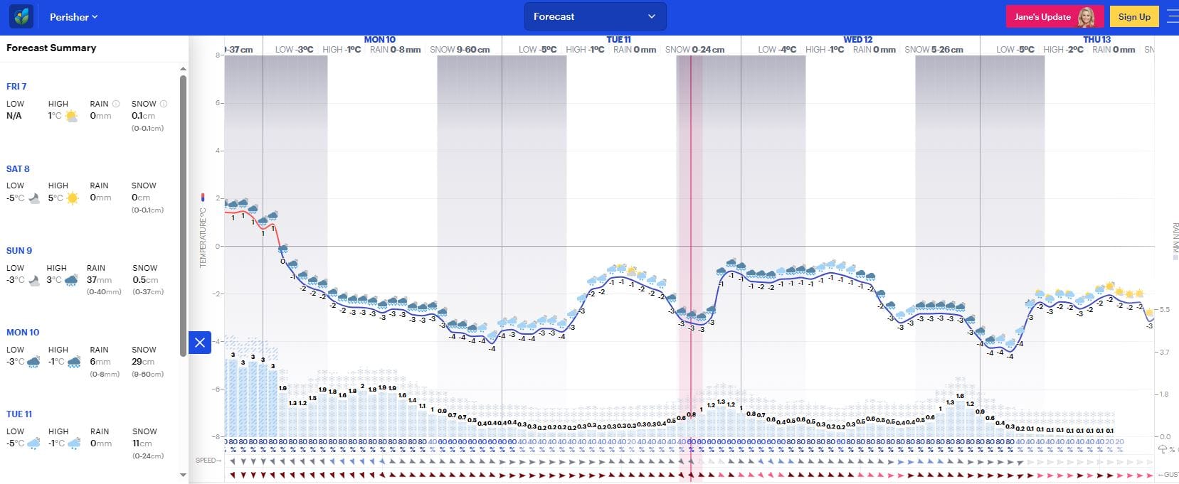
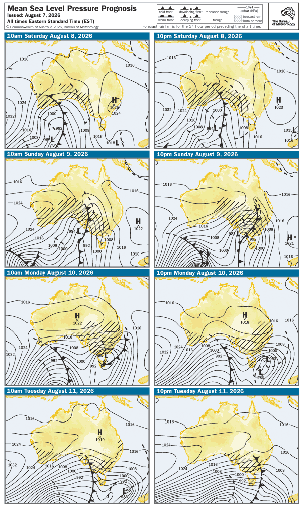
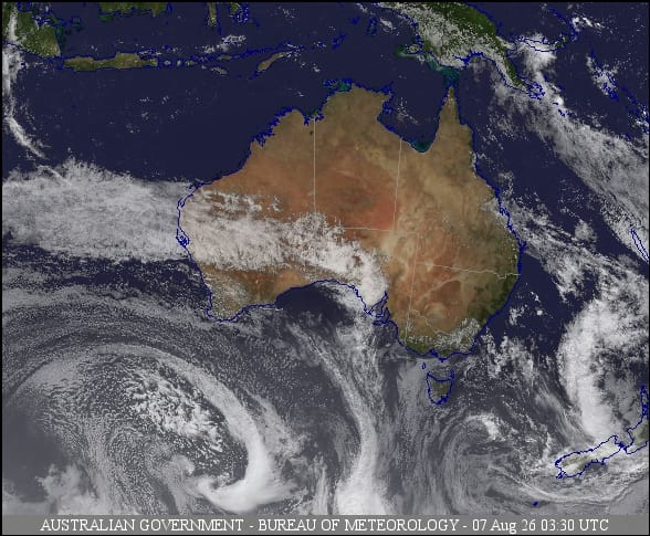
Early next week, the biggest storm of the 2026 season will begin with cold weather, strong to gale-force winds and bucket loads of snow.
Beforehand, though, it will be sunny on Saturday, then rain on Sunday until midnight, when temperatures drop below zero, and heavy snow arrives. If the temperatures drop earlier than expected on Sunday night, there is heavy precipitation before midnight.
There will be strong to gale-force winds with snow down to 1700m on Sunday night, then lowering to 1200m on Monday. Predictions are from hourly forecasts for Perisher, Thredbo and Charlotte Pass. Expect Selwyn’s accumulation to be less than these figures.
Sunday midnight to Monday 9am
10cm to 16cm
Monday 9am to Tuesday 9am
9cm-16cm
Tuesday 9am to Wednesday 9am
6cm-11cm
Wednesday 9am to Thursday 9am
6cm to 12cm
Thursday will be flurries early with the weather improving.
(Note: If we receive more snow, we will take it.)
Predictions are from Janes Weather hourly forecasts, via our weather page.
If you had to pick the days, Tuesday and Wednesday look best, but still cold and very windy.
It would be advisable to check road conditions and lift status starting Monday morning, just to stay up to date.
The latest official snow depth reading was 87.1 cm on August 5, but we have had 10cm of new snow since that reading.
With this storm next week, we should easily surpass an official 120cm base, which will see virtually all off-piste trails with very good cover.
The groomed runs are excellent right now, as they have been constantly topped up with man-made snow, and will be in primo condition with all this fresh snow.
Stay Safe and Enjoy......