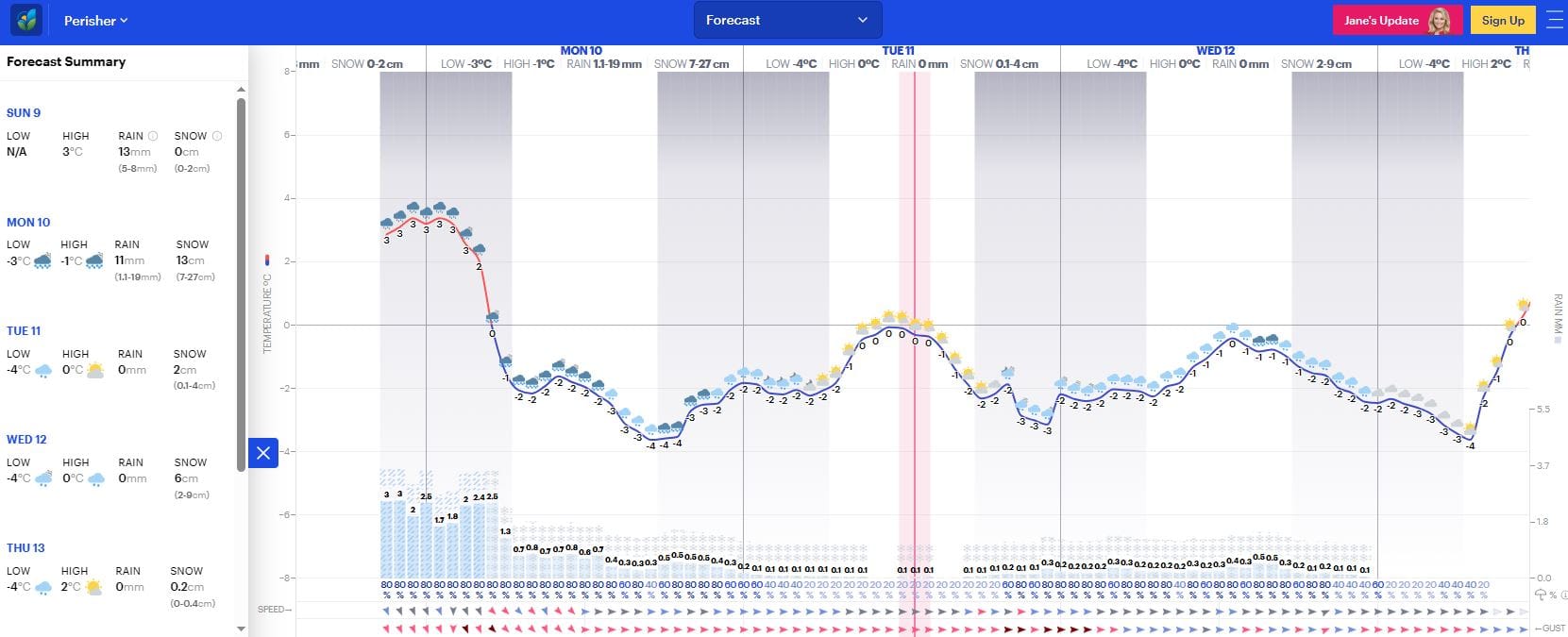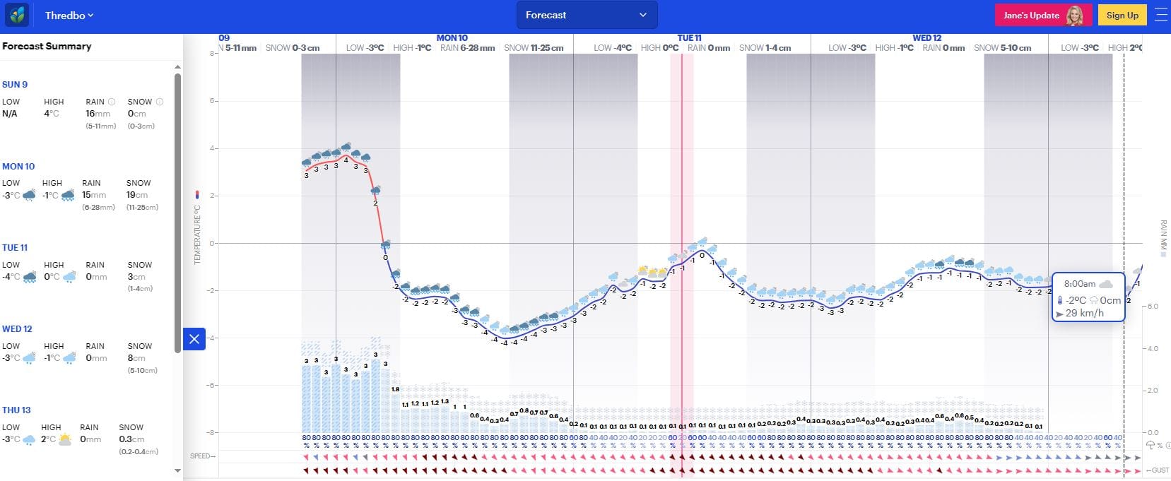





Cold temperatures will now arrive later in NSW than expected from a few days ago, which is not ideal for storm snowfall totals. But this is still a serious weather system with cold temperatures, strong winds and wind chill well below zero. In Thredbo on Sunday, wind chill was down to -21 degrees Celsius.
Sunday saw strong gale-force winds and rain, which will continue overnight into the early morning before temperatures drop about 5am at this stage. This means the heavier Sunday night precipitation period will likely be above zero temperatures, but snow will arrive before lifts open on Monday morning.
How much will really depend on when the temperatures recede. We hope earlier.
Monday will see snow falling all day down to about 1100 metres, with strong winds continuing throughout the day.
Rug up for cold conditions on the slopes for a few days, and expect some lifts to be on wind hold on Monday.
The storm totals appear to have receded from their lofty numbers a few days ago, all due to temperatures. But hey, in Australia we are well used to that.
There will still be fresh snow until Wednesday, and the new snow will repair what was lost due to the damp conditions on Sunday.
Check road conditions before you leave for the resorts on Monday morning, as roads will be snowy and potentially icy once the temperatures drop.
Take it easy on the roads, and wear thermals.
See below for hourly forecasts, as of Sunday night on Janes Weather.